
Updated 9 January 2025 at 22:52 IST
Satellite Photos Show Impact of Disastrous Wildfires In Los Angeles History
Satellite photos show how Los Angeles, California are burning down as major wildfires rages through and firefighters struggle.
- Galleries
- 1 min read

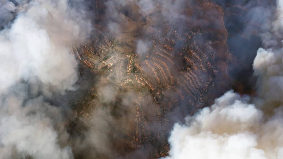
This satellite image provided by Maxar Technologies shows burning and destroyed houses from the Eaton Fire near Marathon Road, Wednesday, Jan 8, 2025, in Altadena, California Image: AP
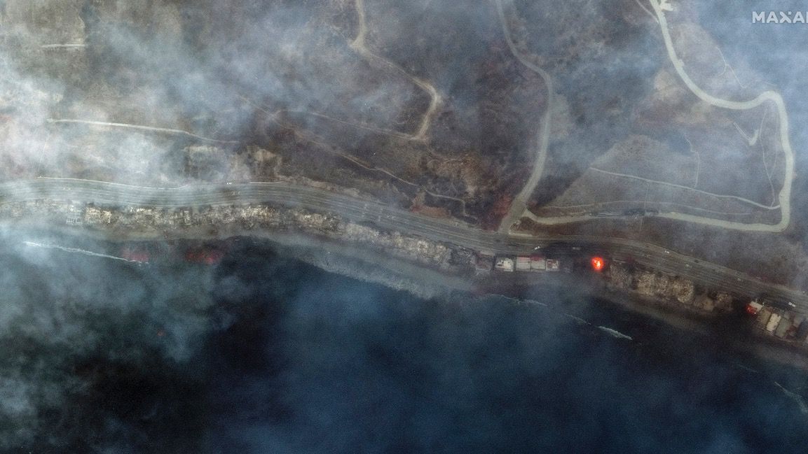
This infrared satellite image provided by Maxar Technologies shows burned structures and active fire burning from the Palisades Fire in Tuna Canyon Wednesday, Jan 8, 2025, in Los Angeles. Image: AP
Advertisement
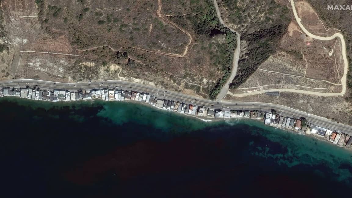
This satellite image provided by Maxar Technologies shows homes and businesses before the Palisades Fire, along Pacific Coast Highway and Tuna Canyon, Oct 20, 2024, in Los Angeles. Image: AP
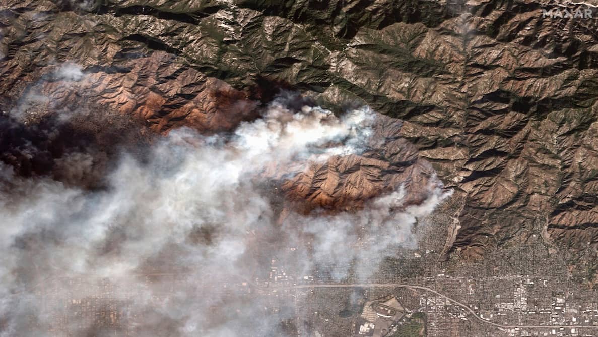
Satellite image provided by Maxar Technologies shows the Eaton Fire burning in and near Altadena, California, Wednesday, Jan 8, 2025. Image: AP
Advertisement
Satellite image taken by Planet Labs PBC, shows the smoke of Palisades Fire is seen over Los Angeles, California on Jan 8, 2025. Image: AP
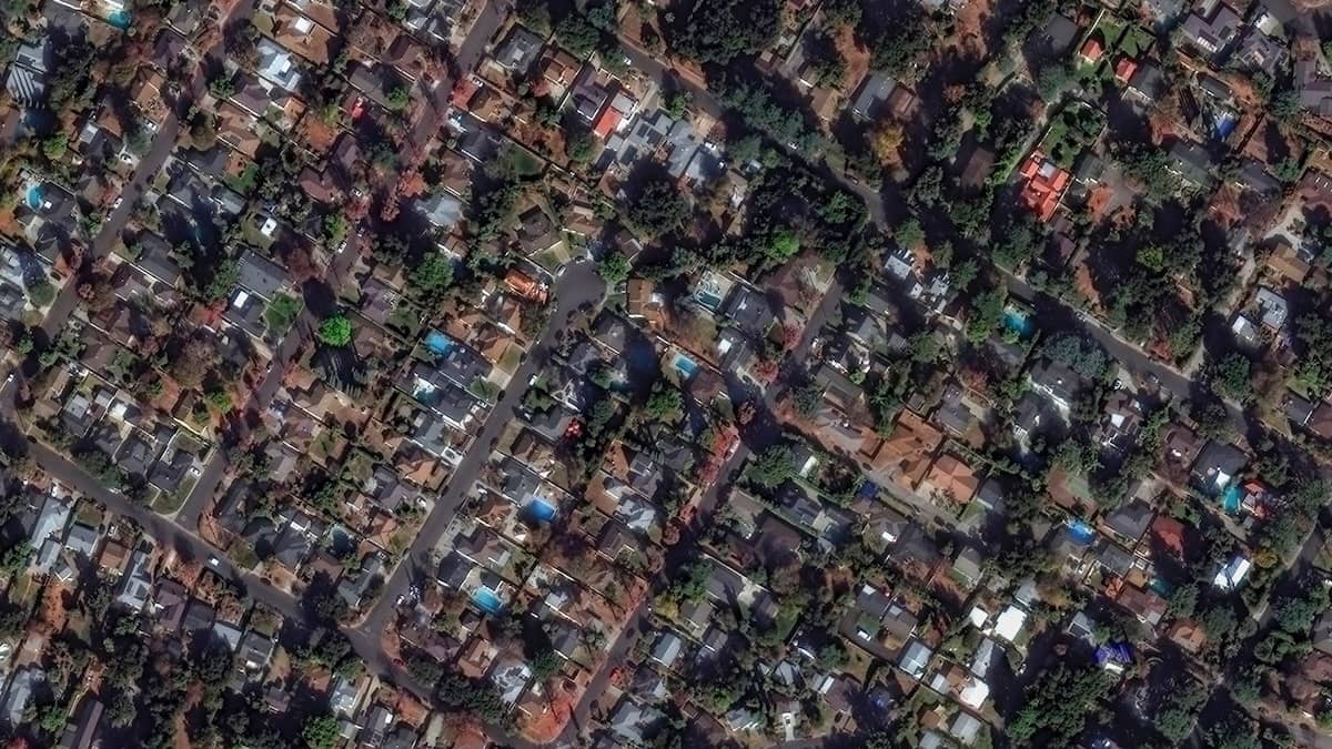
Satellite image provided by Maxar Technologies shows buildings near Marathon Road before the Eaton Fire, Wednesday, Jan 8, 2025, in Altadena, California. Image: AP
Published By : Shashwat Bhandari
Published On: 9 January 2025 at 22:52 IST