Updated 24 June 2024 at 16:14 IST
Breathtaking: This Satellite Image of Majestic 'Ram Setu' Will Leave You Speechless
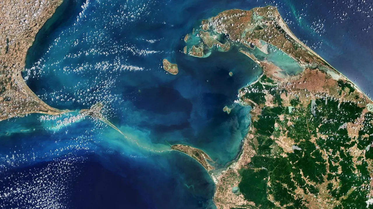
The European Space Agency has shared an image of the Ram Setu taken by its Copernicus Sentinel-2 satellite.
- India News
- 2 min read

Delhi: The European Space Agency has released an image of the Ram Setu, captured by its Copernicus Sentinel-2 satellite. This natural chain of shoals spans 48 kilometers between Rameswaram Island, located off the southeast coast of India, and Mannar Island in Sri Lanka. The Ram Setu serves as a barrier, separating the Gulf of Mannar, an inlet of the Indian Ocean to the south, from the Palk Strait, an inlet of the Bay of Bengal to the north.
About Ram Setu
While there are numerous theories about how the bridge was formed, geologic evidence suggests that these limestone shoals are the remnants of land that once linked India with Sri Lanka.
The European Space Agency said, as per reports, this “natural bridge was traversable until the 15th century, after which it was gradually eroded by storms over the years,”. Space agency noted that some of the sandbanks are dry, while the sea here is very shallow, only 1–10 m deep, as indicated by the light colour of the water.
Advertisement
Covering around 130 sq km, Mannar Island is connected to mainland Sri Lanka by a road bridge and by a railway bridge. Both of them are visible at the southern end of the island.
In India, Rameswaram Island can be accessed via the two-kilometer-long Pamban Bridge. Here, the two main towns are Pamban, on the western edge, and Rameswaram, which is around 10 km east of Pamban.
Advertisement
Both sections of the Ram Setu are part of protected national parks in their respective countries.
"The sand dunes serve as breeding grounds for birds such as the brown noddy, while numerous species of fish and sea grasses thrive in the shallow waters. Sea life around Adam's Bridge includes dolphins, dugongs, and turtles," the European Space Agency added.
What is Sentinel-2?
Sentinel-2 is an Earth observation mission from the Copernicus Programme of the European Space Agency that acquires optical imagery at high spatial resolution (10 m to 60 m) over land and coastal waters. The mission's Sentinel-2A and Sentinel-2B satellites are to be joined in orbit in 2024 by a third, Sentinel-2C.
The mission helps in services and applications such as agricultural monitoring, emergency management, land cover classification, and water quality.
The satellites were manufactured by a consortium led by Airbus Defence and Space in Friedrichshafen, Germany.
Published By : Surabhi Shaurya
Published On: 24 June 2024 at 16:14 IST
