Updated 9 March 2023 at 07:17 IST
ISRO receives India-US jointly developed NISAR satellite for advanced Earth observation
NISAR is a joint Earth-observing mission between the National Aeronautics and Space Administration (NASA) and the Indian Space Research Organization (ISRO).
- Science News
- 2 min read

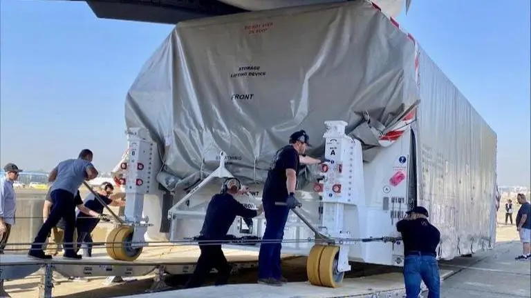
In a big boost to Indo-US ties in space collaboration, the United States handed over NASA-ISRO Synthetic Aperture Radar (NISAR) to the Indian space agency on Wednesday in Karnataka's Bengaluru.
The US Air Force C-17 aircraft took off from California with the NISAR satellite and landed in Bengaluru on Wednesday. The US US Consulate General Chennai confirmed this development and called NISAR a "true symbol of US-India civil collaboration".
Touchdown in Bengaluru! @ISRO receives NISAR (@NASA-ISRO Synthetic Aperture Radar) on a @USAirforce C-17 from @NASAJPL in California, setting the stage for final integration of the Earth observation satellite, a true symbol of #USIndia civil space collaboration. #USIndiaTogether pic.twitter.com/l0a5pa1uxV
— U.S. Consulate General Chennai (@USAndChennai) March 8, 2023
What is NISAR?
According to the National Aeronautics and Space Administration (NASA), NISAR is a joint Earth-observing mission between NASA and the Indian Space Research Organization (ISRO). This mission was envisioned by NASA and ISRO in 2014, eight years prior, as a potent demonstration of the capacity of radar as a research instrument and as a way to further our understanding of Earth's dynamic land and ice surfaces.
NISAR is anticipated to be launched from Satish Dhawan Space Center into a close-polar orbit in January 2024. It is an observatory in low Earth orbit (LEO). The satellite will operate for a minimum of three years. In 12 days, NISAR will map the whole world.
Advertisement
Using two distinct radar frequencies (L-band and S-band), NISAR will be the first radar of its kind in orbit to scan Earth systematically. It will monitor changes in our planet's surface that are smaller than a centimetre across.
To increase our knowledge of Earth system processes and climate change, NISAR will provide a plethora of data and information regarding the Earth's surface changes, natural hazards, and ecosystem disturbances.
Advertisement
Faster reaction times and more accurate risk assessments will be made possible by the mission's provision of vital information to aid in managing natural disasters including earthquakes, tsunamis, and volcanic eruptions. Also, by providing data on crop growth, soil moisture, and land-use changes, NISAR data will be utilised to enhance agriculture management and food security.
Published By : Ajay Sharma
Published On: 9 March 2023 at 07:17 IST
