
2 Monsoons In India: West Braces For Extremely Heavy Rain, South Faces Dry Week
IMD forecasts extremely heavy rain over Gujarat and Madhya Maharashtra on July 22, South India will stay dry for a week, Delhi will see light rain and thunderstorms, with a flash-flood risk in parts of J&K, Himachal, and Uttarakhand.
- India News
- 4 min read

;'%3e%3cpath%20d='m8,15.99c4.41,0,7.99-3.58,7.99-7.99S12.41,0,8,0,0,3.59,0,8s3.58,7.99,7.99,7.99Z'%20style='stroke:%23fff;%20stroke-miterlimit:10;%20stroke-width:.02px;'/%3e%3cpath%20d='m3.08,3.37l3.82,5.11-3.84,4.15h.87l3.37-3.64,2.72,3.64h2.94l-4.04-5.39,3.58-3.87h-.86l-3.1,3.35-2.5-3.35h-2.94Zm1.27.64h1.35l5.97,7.99h-1.35l-5.97-7.99Z'%20style='fill:%23fff;'/%3e%3c/g%3e%3c/svg%3e)


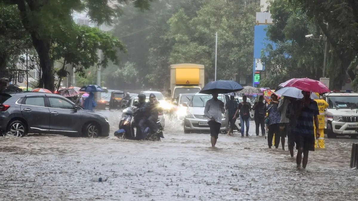
New Delhi: India on Wednesday will wake to a divided monsoon, with parts of the west bracing for torrential rain, while the south is set for another week of dry weather. According to the India Meteorological Department (IMD), the contrast has turned the country into two distinct weather zones in a matter of days, with Gujarat and Madhya Maharashtra bracing for a severe forecast condition.
The IMD has predicted heavy to very heavy showers at a few places, and extremely heavy rain at isolated locations in Gujarat and Maharashtra. The IMD defined extremely heavy rain as more than 204.4 mm in 24 hours, well over 20 cm of water. The scale was already evident on Monday, when Pardi in Valsad district recorded 21 cm in the 24 hours ending 8.30 am on July 21.
Meanwhile, South Peninsular India will see little respite from the dry spell as per the forecast. The weather department expects rainfall there to remain subdued for the next 7 days, with only limited activity. The officials said that it is a classic “active and break” phase, and this year the active part is firmly parked over the north and west.
Where The Rain Will Fall On Wednesday
It is predicted that the heaviest showers are likely to be scattered rather than widespread. The IMD expects isolated very heavy rain across Himachal Pradesh, the Jammu-Kashmir-Ladakh belt, Punjab, East Rajasthan, both East and West Madhya Pradesh, and the Konkan and Goa coast.
Advertisement
Isolated heavy rain is forecast for a long belt running from Uttarakhand through Haryana, Chandigarh and Delhi, across both eastern and western Uttar Pradesh, into Vidarbha, Chhattisgarh, Bihar and Odisha. The northeast will also stay wet, with Assam and Meghalaya as well as the Nagaland-Manipur-Mizoram-Tripura cluster expected to receive rain.
The weather forecast agency explained the reason for the dryness in the peninsula, stating that it is a northward shift of the monsoon trough, the low-pressure belt that pulls rain across the country. Only isolated to scattered showers are likely in Coastal Andhra Pradesh, Rayalaseema, Tamil Nadu, Telangana and interior Karnataka through July 27.
Advertisement
Though coastal Karnataka and Kerala are the exception, as the Western Ghats will continue to wring moisture out of sea winds, these states may still see rain even as the rest of the south stays largely rain-free. On the other hand, the dominant feature for most of the peninsula this week will be gusty winds rather than downpours.
Delhi To See Spells Of Light Rain And Thunder, Flash Flood Risk In The Hills
In the national capital, Wednesday is expected to be generally cloudy, with the IMD saying that there will be one or two spells of very light to light rain at many places from early morning to noon, with moderate rain at a few places, accompanied by thunderstorms, lightning and winds of 20 to 30 kmph gusting to 40 kmph. A second spell is probable between evening and night, with temperatures expected to stay below normal, with a maximum of 31 to 33 degrees Celsius and a minimum of 24 to 26 degrees.
Talking about the weather conditions in the hilly areas, the risk of sudden flooding is highest in the mountains. The flash flood guidance valid until the early hours of July 22 flags a low to moderate risk over watersheds in Jammu and Kashmir and Ladakh. In Himachal Pradesh, districts including Chamba, Kangra, Kullu, Shimla and Kinnaur are on watch, while in Uttarakhand the concern covers Dehradun, Uttarkashi, Chamoli and Pithoragarh. The officials stated that with the ground already saturated, fresh rain will run straight off slopes rather than soak in, and district-level warnings are being updated accordingly.
The meteorologists asserted that 5 upper-air cyclonic circulations are feeding the trough, and these spinning columns of air sit over Haryana, northeast Madhya Pradesh, southwest Rajasthan, north Chhattisgarh and the west-central Bay of Bengal. A trough also links the bay circulation to the northeast Arabian Sea, tying both seas into one rain engine over the north and west while bypassing the south.
The scientists called the pattern as active and break phases of the monsoon. The trend is also getting more extreme, with some research finding extreme rain events over central India are increasing even as moderate rain declines. The fishermen have been advised to stay off the sea off Gujarat and north Maharashtra until July 24, and off the Andhra Pradesh coast until July 22.
Get Current Updates on India News, Entertainment News, Cricket News along with Latest News and Web Stories from India and around the world.