Updated 21 November 2020 at 19:01 IST
NASA to launch 'Sentinel-6' satellite to track Earth's rising sea level, how to watch live
NASA’s next-generation satellite was manufactured in collaboration with the European Space Agency and will launch from Vandenberg Air Force Base in California.
- Science News
- 3 min read

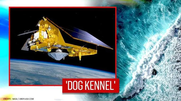
NASA is set to launch the world's newest ‘sea level-measuring’ satellite named Sentinel-6 Michael Freilich on Nov. 21 at 9:17 am PT. Orbiting at over 830 miles above the planet Earth, the satellite dubbed as ‘Dog kennel’ will monitor the global sea levels in an initiative to combat the risks associated with climate change. NASA’s next-generation spacecraft was manufactured in collaboration with the European Space Agency and will launch on Saturday from Vandenberg Air Force Base in California, US.
According to an update shared by the space agency, the historic truck-size satellite launch through SpaceX’s Falcon 9 rocket will be live-streamed across various platforms, including NASA TV, NASA’s Facebook, and on NASA and JPL’s official Twitter handle. The launch coverage of the Sentinel-6 Michael Freilich satellite which will commence at 8:45 am PST (11:45 a.m. EST) will also be updated on NASA’s official blog. The Launch Readiness Review for the satellite has already concluded. NASA’s Launch Services Program, SpaceX, the European Space Agency (ESA), and NOAA will lift off the mission from the Space Launch Complex 4. “Currently, the 30th Space Wing weather forecast is 80 percent ‘go’ for launch, with a 20% chance of violating weather constraints,” NASA informed.
Advanced metering accuracy
While many satellites over the years have assisted scientists in weather-related information, NASA’s latest launch will focus on tracking more accurate updates about the sea levels. The 'Dog Kennel', as per NASA’s scientists is equipped with advanced technology that will ensure a higher metering accuracy which can trace the gigantic topographical features on the Earth’s surface such as lakes, Gulf Stream, Large water bodies, and minute non-traceable features from space such as the thin shorelines. The satellite can also trace the hurricanes and other natural calamities that might impact the sea levels.
Sentinel-6 Michael Freilich will use GPS satellites to determine its exact location in space which allows researchers on the ground to know where the precise measurement was taken over the ocean. More in #ScienceInSeconds with @NASAJPL's Angie Dorsey: https://t.co/a0URh8FZes pic.twitter.com/GdLC9cyb6E
— Thomas Zurbuchen (@Dr_ThomasZ) November 20, 2020
Sentinel-6 is expected to accumulate the weather forecasting data in space such as the humidity and atmospheric temperature to help scientists research the impact of the changing global sea levels. The launch is a part of a two-pronged mission and a twin satellite, the second, Sentinel-6B satellite will lift off in 2025.
Advertisement
LAUNCH ALERT! 🚀 Nov 21 9:17am PT (17:17 GMT)
— NASA JPL (@NASAJPL) November 21, 2020
Watch & chat as #Sentinel6 Michael Freilich rises on a #Falcon9 📺 https://t.co/NZ8Id9ErdH
🌍 @NASAEarth @ESA_EO
🛰 @NASA @NASAJPL @NASAKennedy
🚀 @NASA_LSP @30thSpaceWing @SpaceX
💨 @NOAASatellites @eumetsat @CNES#SeeingTheSeas pic.twitter.com/EZAM35de2I
Rollout of the @SpaceX #Falcon9 rocket with Sentinel-6 Michael Freilich was completed this afternoon.
— NASA's Launch Services Program (@NASA_LSP) November 21, 2020
The Earth-observing mission is slated to launch tomorrow, Nov. 21, at 9:17 a.m. PT from @30thSpaceWing in California: https://t.co/siskEuAi9h #SeeingTheSeas 🌊 pic.twitter.com/5tS6iVirVz
Advertisement
“This mission is a global partnership that is needed to study our planet because it is ours,” Thomas Zurbuchen, associate director of NASA’s Science Mission Directorate, said during a press conference.
“To understand what climate change means to humankind, science must take a long look. This mission is to follow 30 years of continuous measurements by spacecraft that orbit Earth,” he said. Further, Zurbuchen added that NASA will have “another decade” of important measurements from this perspective.
LIVE NOW🔴
— NASA JPL (@NASAJPL) November 20, 2020
The Sentinel-6 Michael Freilich satellite is set to launch tomorrow, Nov. 21 from @30thSpaceWing! Tune in to learn about the science of this U.S-European mission, which will monitor sea level and support weather forecasting. #SeeingTheSeas https://t.co/MdsJOu82U4
Published By : Zaini Majeed
Published On: 21 November 2020 at 19:02 IST
