Mumbai Weather Today: IMD Issues Second Red Alert in 24 Hours Amid Heavy Rain and Thunderstorm Warnings
Mumbai Rains: Mumbai faces a second red alert in 24 hours as heavy rains continue to lash the city. IMD warns of thunderstorms, while local train services face major disruptions.
- India News
- 4 min read

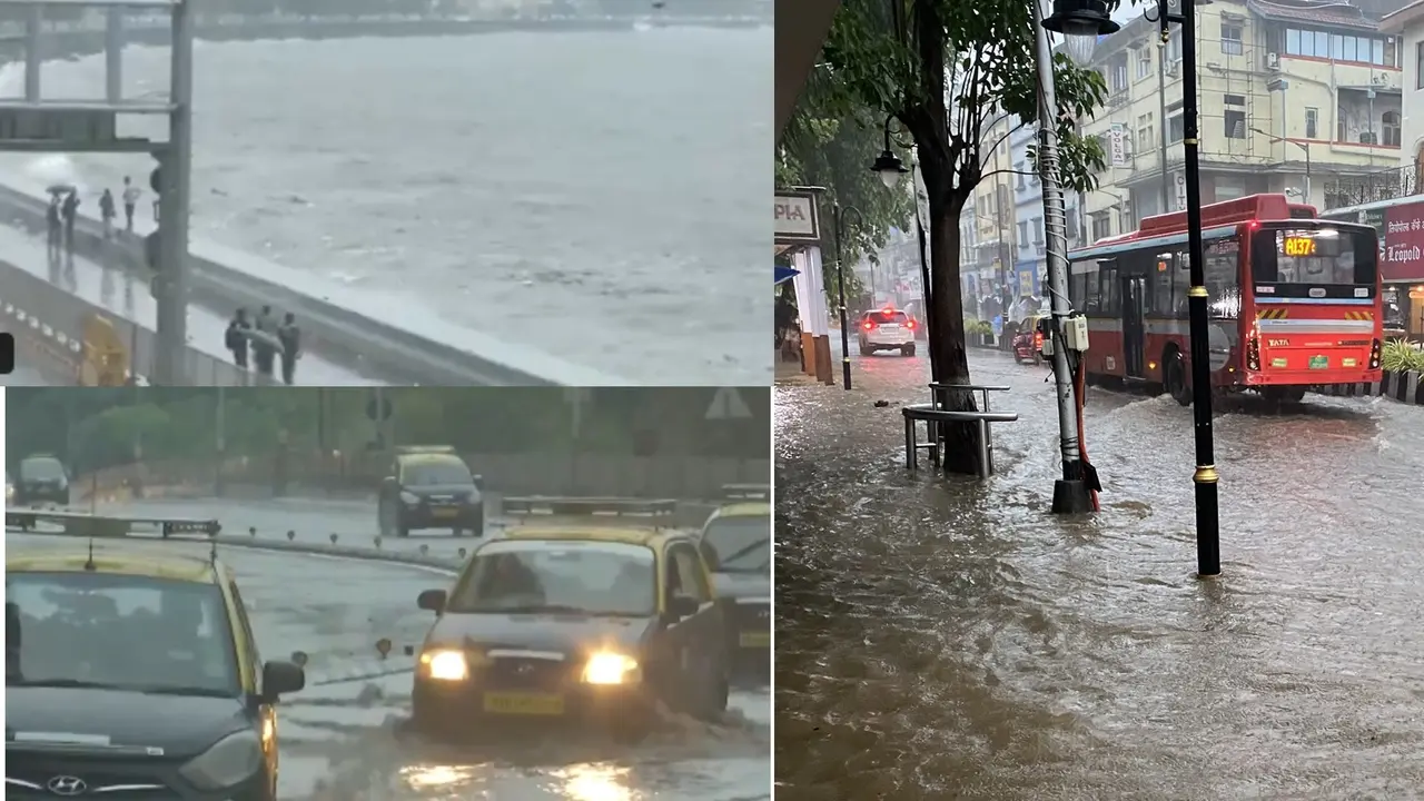
Mumbai: Mumbai has been experiencing continuous heavy rainfall since May 25, with South Mumbai being the most affected. Colaba recorded 144.3 mm of rain, while Santacruz received 74.3 mm. The India Meteorological Department (IMD) has issued a Red Alert for the city, warning of more heavy rain, thunderstorms, lightning, and strong winds.
This is the second red alert in the past 24 hours. Several areas, including Nariman Point, the Ward Municipal Office, Colaba Pumping Station, and Colaba Fire Station, received more than 200 mm of rainfall from Sunday night to Monday morning. This has caused severe waterlogging, affecting road traffic and normal daily activities.
Rain is expected to continue along the Konkan coast and nearby hilly areas, including Ratnagiri and Goa. Red Alerts have also been issued for Pune and Satara, where extremely heavy rainfall could lead to localized flooding and disruptions.
In coastal districts like Thane, Raigad, and other parts of Konkan, the IMD has issued an Orange Alert for very heavy rain. Conditions may worsen in some areas.
Advertisement
Suburban train services, particularly on the Harbour Line, are facing delays and cancellations due to waterlogging.
Weather Warnings Across India
Severe Rainfall and Red Alerts for Kerala and Karnataka (May 25–31)
Both Kerala and Karnataka are under a Red Alert issued by the IMD from May 25 to 31, with forecasts of extremely heavy rainfall, particularly in the coastal belts and hilly regions. Isolated cloudburst events are also possible. The intense rain raises the risk of flooding and landslides, especially in the Western Ghats and other vulnerable areas.
Advertisement
Lightning and Heavy Rain Forecast for Northeastern States
The IMD has issued alerts for Delhi and the northeastern states including Assam, Meghalaya, and Tripura, warning of lightning and heavy rainfall until May 31. The most intense downpours are expected between May 28 and 31, with the potential for localized flooding and travel disruptions.
Thunderstorms and Gusty Winds Expected in Gujarat and MP
Gujarat and Madhya Maharashtra are likely to experience thunderstorms accompanied by gusty winds over the coming days. While rainfall in these regions may not be as extreme as in southern states, sudden weather changes could affect daily life and travel plans.
East Coast Weather Forecast (May 29 – June 1)
Starting May 29, the weather system will shift toward India’s east coast. Widespread rainfall is expected in West Bengal, Odisha, Andhra Pradesh, Telangana, Madhya Pradesh, Tamil Nadu, and parts of Kerala (especially near the ghats). Heavy to very heavy rainfall, thunderstorms, and gusty winds (up to 60 km/h) are forecast, which could result in flash floods in some areas.
Impact on Daily Life in Mumbai
Due to the heavy rainfall, severe waterlogging has been reported in many areas of Mumbai, including locations that usually remain unaffected. Roads are flooded, public transport is disrupted, and flight delays have occurred. Notably:
Acharya Atre Chowk Metro Station, recently opened, saw waterlogging.
Access to Mantralaya was partially flooded; employees had to wade through knee-deep water.
Over 50 Central Railway and 18 Western Railway services were cancelled.
Several Air India flights were diverted due to poor weather conditions.
Reports of building and wall collapses came from areas such as Mahim, Malabar Hill, and Teen Batti. A road cracked open in Kemps Corner, and tree falls were also recorded. Around a dozen BEST buses were stuck on waterlogged roads, and 20 routes were diverted.
IMD Safety Advisory: Precautions for Lightning, Flooding, and Storms
Avoid Open Spaces: Residents are urged to stay indoors, especially during thunderstorms.
Stay Away from Trees & Water Bodies: Lightning strikes and flash floods are risks, so people should avoid seeking shelter under trees or near water bodies.
Get Current Updates on India News, Entertainment News, Cricket News along with Latest News and Web Stories from India and around the world.
