
NASA satellite data helps scientists evaluate risks faced by Belize coral reef
Scientists recently evaluated the risks and threats faced by Belize's coral reefs by creating a toolkit with satellite data gathered by NASA.
- Science News
- 2 min read

;'%3e%3cpath%20d='m8,15.99c4.41,0,7.99-3.58,7.99-7.99S12.41,0,8,0,0,3.59,0,8s3.58,7.99,7.99,7.99Z'%20style='stroke:%23fff;%20stroke-miterlimit:10;%20stroke-width:.02px;'/%3e%3cpath%20d='m3.08,3.37l3.82,5.11-3.84,4.15h.87l3.37-3.64,2.72,3.64h2.94l-4.04-5.39,3.58-3.87h-.86l-3.1,3.35-2.5-3.35h-2.94Zm1.27.64h1.35l5.97,7.99h-1.35l-5.97-7.99Z'%20style='fill:%23fff;'/%3e%3c/g%3e%3c/svg%3e)


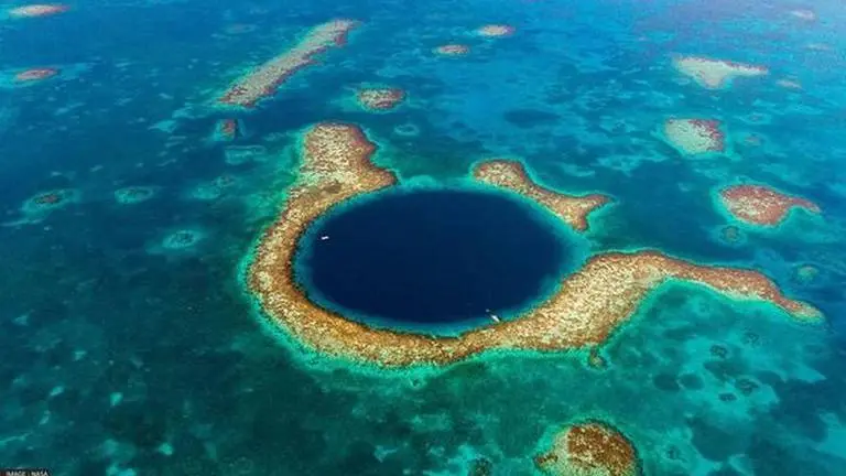
Scientists recently evaluated the risks and threats faced by Belize's coral reefs by creating a toolkit through two decades of satellite data gathered by NASA. Their assessment paves the way for local authorities to find ways and take actionable steps to protect reefs from deterioration caused by pollution, climate change and excessive fishing activities.
In a study published in the Frontiers in Remote Sensing journal, researchers ranked 24 marine protected areas off the Belize coast on the basis of the risks that coral reefs face, such as warmer temperatures and murky waters. Belize is renowned for its coral reefs, which spread 185 miles off its coast and hold within rich marine environments.
The barrier reef system also draws in large numbers of tourists - the driving force of the Central American country's economy. Belize's barrier reef system is one of the 1,200 UNESCO World Heritage sites spread all around the world. “We depend on the reef for so many things, so conserving these resources is important,” said the study's co-author Emil Cherrington, who is a native of Belize.
New toolkit to help assess coral reef systems around the world
The study revealed that researchers at NASA’s Jet Propulsion Laboratory in Southern California and those in Belize accessed free cloud data on Google Earth Engine to formulate their analysis. “Studies like this are giving the government of Belize more tools for conserving the resources that the country has," Cherrington said, according to NASA's official website.
Advertisement
The assessment made by scientists with the help of NASA data could help experts understand the vulnerability of other reef systems around the world. “We were trying to make the data and our approach as accessible as possible. Our main purpose was to make a toolkit that would be easy to use, that would produce an index that was easy to understand, and that could be used to see which marine protected areas may need closer attention," said Ileana Callejas, the lead author of the study and a graduate student at the University of California, Los Angeles.